
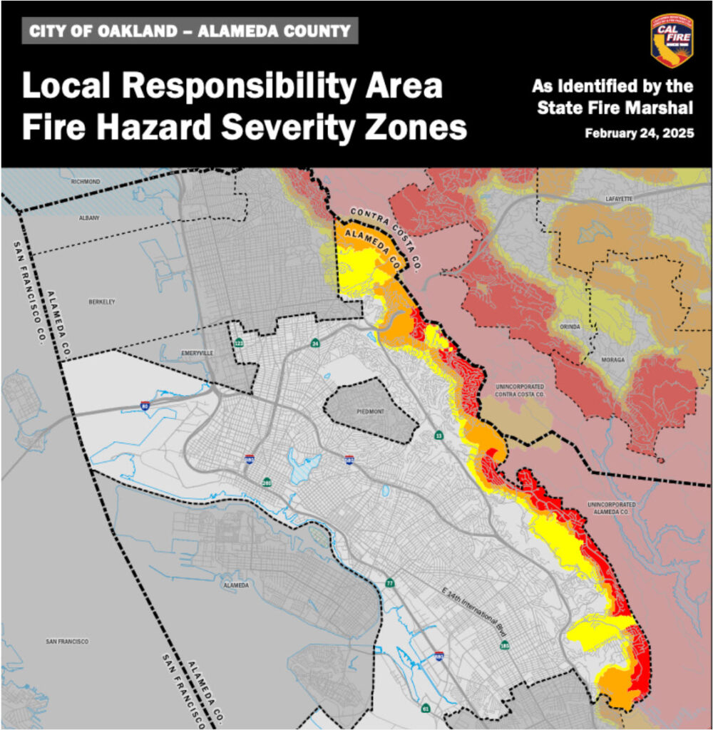
On February 24th, 2025, CAL FIRE released its updated draft Local Responsibility Area (LRA) Fire Hazard Severity Zone maps, which include the Oakland/Berkeley hills.
While these were expected updates following previously updated State Responsibility Area (SRA) maps, what was unexpected and surprising was that the High and Very High Fire Hazard Severity Zone (FHSZ) areas, especially in the Oakland hills, were significantly decreased in size.
Most folks involved in wildfire safety, including OFSC, had expected an increase in size…!
This of course has led to much confusion.
Note that these are still draft LRA maps, and are subject to change based on local fire agencies, including OFD, providing their input back to CAL FIRE.
While we are waiting for final decisions from OFD (due by end of June) and finalized maps, we should all keep in mind:
- nothing fundamental has changed–many of us still live in or adjacent to a very high wildfire risk area with a significant number of trees and other foliage, steep terrain, limited evacuation routes, etc, while year-after-year warming continues to dry out vegetation–these all contribute to our City being at-risk of a devastating wildfire as occurred in LA this past January
- we should all continue to prepare for wildfire (and other disasters), harden our homes against embers and flames, especially in the Zone 0 area 5′ around the structure, and implement wildfire safety programs such as Firewise USA and fire-smart Firescaping
- and don’t expect home insurance issues to necessarily improve due to these updated LRA maps–while insurance companies do refer to CAL FIRE fire severity zones, they also utilize their own wildfire threat analysis including satellite and even drone imagery
OFSC will continue to monitor updates to the draft CAL FIRE LRA maps for our area, and as soon as we have more information from OFD or CAL FIRE, we will be sure to inform you.
Thanking OFSC volunteers Christophe Marcant and Maryanne Hubbard for their contributions to this content.